Does a fire hazard zone lower home value in California?
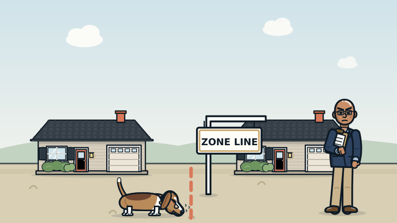
It can, but there is no fixed discount. California's Fire Hazard Severity Zones, mapped by the Office of the State Fire Marshal, trigger seller disclosures, defensible space rules and stricter building codes. Buyers react through insurance cost, price and days on market, so an appraiser measures the effect with local sales inside and outside the zone.
What the state fire map actually measures
California's Office of the State Fire Marshal (OSFM, part of CAL FIRE) draws the Fire Hazard Severity Zone maps. Each area is rated Moderate, High or Very High.
There are two sets of maps. One covers the State Responsibility Area, where the state handles wildfire protection. That map took effect April 1, 2024. The other covers the Local Responsibility Area, meaning cities and places with their own fire departments. OSFM sent those maps out in phases in early 2025, and each local agency then had 120 days to adopt them by ordinance.
Here is the part most people miss. OSFM's own FAQ says the map rates hazard, not risk. Hazard is about the land: slope, plants, weather and how fire tends to behave there over time. The map does not count home hardening, recent fires or fuel cleanup. So it does not care that you just pulled out every juniper on the lot. It is a map of the hill, not a report card on your house.
What the zone changes when you buy or sell
A zone label is not a price. It does come with paperwork and rules that buyers notice.
- Disclosure. Under Civil Code section 1103 and the form in section 1103.2, the seller's Natural Hazard Disclosure Statement says whether the home is in a High or Very High Fire Hazard Severity Zone, or in a wildland area that may carry substantial forest fire risk.
- Defensible space at sale. Since July 1, 2021, Civil Code section 1102.19 requires a seller in a High or Very High zone to give the buyer documentation that the property meets defensible space rules, under state law or a local ordinance. If that is not done by closing, the buyer agrees in writing to get it within one year. How inspections work depends on your city or fire district.
- Clearing brush. In Very High zones, state law generally calls for 100 feet of defensible space, unless the local rule is stricter.
- Building codes. New homes in High and Very High local zones follow the ignition-resistant rules in Chapter 7A of the California Building Code. Some cities apply them to remodels too.
- Zone 0. In August 2026 the state Board of Forestry adopted emergency rules for the five feet right around a home. Deadlines phase in over several years. Ask your local fire agency for the current dates.
Insurance is where buyers feel it
Most buyers do not read hazard maps for fun. They feel the zone when the insurance quote shows up.
The California Department of Insurance has said plainly that CAL FIRE's hazard maps are not used for insurance rates or underwriting. Insurers use their own wildfire risk models. So a home can sit just outside a mapped zone and still get a hard time from an insurer, or sit inside one and get a decent quote.
The Department's Safer from Wildfires regulation, approved in 2022, requires insurers to recognize safety steps like upgraded roofs and windows and defensible space in their rates. Insurers must also give owners their property's wildfire risk score and a way to appeal it. When regular coverage is not available, the California FAIR Plan offers a limited fire policy, and owners often add a separate Difference in Conditions policy for things like water damage and liability.
Why does this matter for value? Buyers shop by monthly payment. A higher insurance bill takes a bite out of what they can offer, the same way a higher interest rate does. For coverage details, talk to a licensed insurance agent or broker. To see why a rebuild estimate is a different number from market value, read insurance replacement cost vs market value.
How I measure the effect instead of guessing
I do not start with a percentage. There is no honest statewide number to borrow. The effect in the Oakland hills will not match the effect in the foothills of Orange County, and neither has to match the last headline you read.
Here is how I build the evidence:
- Sales on both sides of the line. Zone lines often run right through a neighborhood. Similar homes close in time, one inside the zone and one outside, are paired sales. That is the cleanest test there is.
- Before and after the new maps. If a pocket was newly added in 2024 or 2025, I compare sales before and after, adjusted for the overall market trend, so I do not blame the map for a rate change.
- Days on market and sale to list price. Sometimes buyers still pay the price but take longer to commit. That shows up in time on market before it shows up in price.
- The most recent window the data supports. Insurance news can move a market fast. A lazy 12-month average can hide what happened last quarter.
Hypothetical: say two similar ranch homes sit on the same hillside street in Contra Costa County, and the map line runs between them. If they keep selling within a hair of each other, the zone is not moving price there. If the one inside keeps selling for less, I measure how much, check it against the wider area and put the number on the grid. If you want the method in more detail, see paired sales analysis.
What I see in the field
The most common mistake is treating the map label like a price tag. Sellers fear it will cost them a fixed chunk. Buyers hope it will hand them a fixed discount. The sales usually tell a quieter story, and it is different street by street.
The second thing I see is that two homes in the same zone are not the same risk to an insurer. A home with a newer Class A roof, ember-resistant vents and a cleared yard can insure very differently from the house next door with a woodpile against the siding. Those facts belong in the property description, with records to back them up.
The third is surprise. Some buyers learn about the zone for the first time when the disclosure packet arrives. Nobody enjoys finding a new monthly bill on page 14. Facts early make for calmer escrows.
My job is to report what the market actually did. If the sales show buyers paying less, the appraisal says so and shows the proof. If they do not, the appraisal says that too.
What to do before you list or buy
- Look up the address on the OSFM Fire Hazard Severity Zone map, and check whether your city has adopted the newer local map.
- Order the Natural Hazard Disclosure report early so nobody is surprised mid-escrow.
- Book the defensible space inspection early if your area requires one. Some inspections take a while to schedule.
- Get insurance quotes during the contingency period, not the week before closing.
- Gather proof of hardening: roof type and date, vents, windows, siding and yard work, with receipts and photos.
- Ask for evidence. A good appraisal shows sales inside and outside the zone, not a guess. I work across the state, so see my California appraisal services if you need a value that shows the work.
Paperwork will never be as exciting as picking tile. It is still what keeps a fire zone from turning into a price fight.
Key takeaways
- California's fire zone maps rate the land's hazard, not your home's actual risk.
- A High or Very High zone triggers disclosure, defensible space and building rules.
- Insurers use their own risk models, not the CAL FIRE maps, so get quotes early.
- There is no fixed fire zone discount; an appraiser measures it with local sales.
- Proof of hardening and a cleared yard are facts worth putting in front of buyers.
Getting this answered in California
High and Very High fire hazard zones cover much of the hills and foothills in places like the Los Angeles County foothills, the East Bay hills of Alameda and Contra Costa counties, and the wine country of Sonoma and Napa. I am a California Certified Residential Appraiser (License AR041465) and appraise homes statewide, including Los Angeles County, Contra Costa County, Alameda County, Sonoma County, Napa County. See every area I serve.
Get the best posts once a week.
Priced Right is one email a week with the most useful appraisal and pricing posts and what the market is doing. Never more than one a week. Unsubscribe anytime.
People also ask
Does a fire hazard zone lower home value in California?
Sometimes, but not by a set amount. The effect depends on how local buyers react to insurance cost and risk, and it is measured by comparing similar sales inside and outside the zone.
How do I find out if my California home is in a fire hazard zone?
Look up the address on the Office of the State Fire Marshal's Fire Hazard Severity Zone map. The Natural Hazard Disclosure report in a sale will also list it, and your city or county can tell you which local map it has adopted.
Do CAL FIRE hazard maps raise my homeowners insurance?
The California Department of Insurance says the CAL FIRE maps are not used for insurance rates or underwriting. Insurers use their own wildfire risk models, and they must recognize certain safety steps under the state's Safer from Wildfires rules.
What does a seller have to do in a California fire zone?
The seller discloses the zone on the Natural Hazard Disclosure Statement. In a High or Very High zone, the seller also provides defensible space documentation under Civil Code section 1102.19, or the buyer agrees in writing to get it within one year of closing.
Sources
- Office of the State Fire Marshal: Fire Hazard Severity Zones
- California Department of Insurance: CAL FIRE hazard maps do not affect insurance rates or availability
- California Department of Insurance: Commissioner enforces wildfire safety regulation (Safer from Wildfires), October 2022
- California Civil Code section 1103.2: Natural Hazard Disclosure Statement
- OSFM Information Bulletin 21-007: AB 38 defensible space disclosure guidance (Civil Code 1102.19)
Got a question we haven't answered?
Suggest a topic or ask your own appraisal question. The best ones become posts.