How is a hillside lot valued in California if most is too steep?
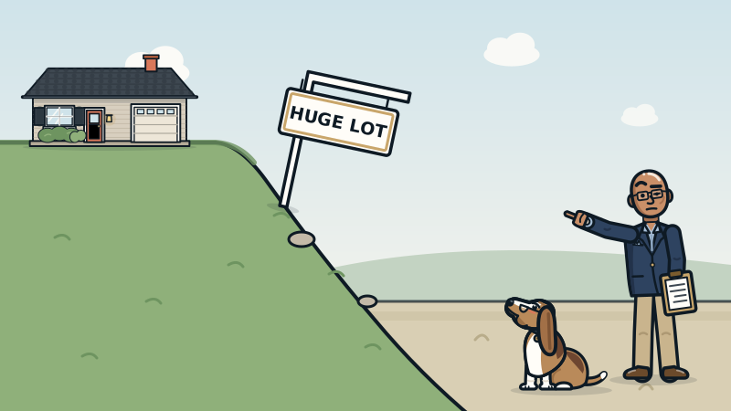
On a California hillside lot, value follows the usable area buyers can actually build on or enjoy, not the recorded lot size. The full lot size still gets reported, as Fannie Mae requires, but slope, setbacks, access and any state Seismic Hazard Zone for landslides decide how much of it buyers pay for.
A big number on the county record is not a big yard
Hillside listings love the lot size. "Over a quarter acre!" Then you get there and three quarters of that quarter acre is a slope that only a mountain goat or a very motivated gardener could use.
The county record measures the whole parcel, flat or not. It does not care that the back 8,000 square feet tilts like a ski run. Buyers do care. They pay for room to live: a level yard, a spot for a deck, space to add on, a safe place to park. That is the usable area.
My rule on hillside lots is simple. Usable area governs the site adjustment. The recorded lot size still prints on the report right alongside it, so a reader can see both numbers and why one carries the weight. Fannie Mae requires the appraisal to report the actual size of the whole site, not a hypothetical portion of it. I follow that. I just do not let a steep slope pretend to be a backyard.
Why price per lot square foot falls apart on a hill
Here is a hypothetical with round numbers, only to show the math. Two homes on the same hillside street sold close together, at the same price.
| Item | Lot A | Lot B |
|---|---|---|
| Recorded lot size | 15,000 sq ft | 7,500 sq ft |
| Usable, mostly level area | 4,000 sq ft | 5,000 sq ft |
| Sale price | $1,200,000 | $1,200,000 |
Divide price by lot size and Lot B looks like it sold for twice as much per square foot of land. Somebody will call Lot A a steal. It is not a steal. Lot B has more ground buyers can actually use. The extra 7,500 square feet on Lot A is mostly hillside, and the market barely paid for it.
That is why I do not price hillside land by dividing. Price per square foot of lot treats a cliff and a lawn as the same dirt. Ask anyone who has tried to set up a patio table on a 40 percent grade.
What shrinks usable area besides the slope
Slope is the obvious one. A few others matter just as much in California's hills:
- Building rules tied to slope. In the City of Los Angeles, the hillside rules use slope bands, and steeper parts of a lot allow less floor area. Other cities have their own hillside standards, so check with the local planning department.
- Setbacks and easements. Required distances from property lines, plus utility or access easements, can take a big bite out of the flat part.
- Landslide zones. The California Geological Survey maps Seismic Hazard Zones for earthquake-induced landslides and liquefaction under the Seismic Hazards Mapping Act of 1990 (Public Resources Code sections 2690 to 2699.6). In those zones, most new building permits require a site-specific study by a licensed engineering geologist or civil engineer first. Sellers or their agents must disclose that a property is in a mapped zone.
- Access. A steep driveway, a long stair climb, or parking only on a narrow street all change what buyers will pay.
None of these comes with a fixed discount. Each one is a fact to find, then measure.
How I measure it with real sales
First I sort the comparable sales (comps) by what they actually offer, not by the number on the county record. A hillside home gets compared to other homes with similar usable ground, similar access and a similar view, in the same pocket when the sales allow it.
Then I measure the site difference with paired sales: two similar homes that differ mainly in one thing, so the price gap shows what that one thing is worth. When the hillside street is too thin, I confirm the rate across a wider set of sales before I trust it.
Each difference goes on the line that names it. Usable site goes on the site line. A view goes on the view line. A brutal driveway goes where it belongs and gets explained. Stuffing a view into the site adjustment makes a report harder to read and easier to argue with.
Where does the usable area figure come from? A survey, a topographic map, a site plan, a soils or geotechnical report, permits and my own walk of the site. For large lots and acreage I also review the parcel on aerial imagery. On an ordinary tract lot, I work from the records and what I can see on site, and I say so.
What I see in the field
The Oakland and Berkeley hills, Marin County, the hillside neighborhoods of Los Angeles and the Santa Cruz Mountains all share the same trap. Someone takes the biggest lot on the street, multiplies its size by the neighborhood's land price per foot, and adds six figures for a slope nobody can stand on.
The reverse happens too. A modest recorded lot with a wide, level pad and a flat driveway can outsell a much bigger parcel next door. Buyers walk the yard, not the plat map.
Hills also bring real upside. Views, privacy and quiet streets often live on slopes, and buyers pay for them. That upside is real when the sales show it. It just belongs on its own line, measured, not hidden inside a lot size that was never usable to begin with. Facts over feelings, and gravity is a fact.
What to do before you price or buy a hillside home
- Pull the recorded lot size from the title or county record, then estimate the usable part separately. Write both down.
- Gather the paper: survey, topo map, site plan, soils or geotechnical reports and permits for retaining walls or decks.
- Read the Natural Hazard Disclosure and check the state's earthquake zone maps for landslide zones.
- Call the planning department about hillside rules, setbacks and what could be added on the lot.
- Compare homes with similar usable ground, rather than similar lot numbers, and put views and access on their own lines.
- Get evidence when the stakes are high. A pre-listing or private appraisal can measure what your slope, pad and view are worth in your market.
For questions about soil stability or retaining walls, that is a job for a licensed geotechnical engineer, not an appraiser with a tape measure.
Key takeaways
- On a hillside lot, usable area drives value. Recorded lot size is reported alongside it.
- Price per square foot of lot treats a cliff and a lawn as the same land.
- Slope rules, setbacks, landslide zones and access all shrink what buyers pay for.
- Views and privacy are real upside, but they go on their own lines, measured with sales.
Getting this answered in California
Hillside lots are common in the Oakland and Berkeley hills, Marin County, the hillside neighborhoods of Los Angeles and the Santa Cruz Mountains, where recorded lot size and usable ground often differ. I am a California Certified Residential Appraiser (License AR041465) and appraise homes statewide, including Alameda County, Contra Costa County, Marin County, Los Angeles County, Santa Cruz County. See every area I serve.
Get the best posts once a week.
Priced Right is one email a week with the most useful appraisal and pricing posts and what the market is doing. Never more than one a week. Unsubscribe anytime.
People also ask
Does a steep lot lower home value in California?
Steep land that cannot be used usually adds little value, so a big hillside lot may be worth about the same as a smaller flat one. How much less depends on local sales, access, building limits and any view the slope brings.
Do appraisers use the full lot size or the usable lot size?
Both appear in a good report. Fannie Mae requires the full site size to be reported, and I base the site adjustment on usable area, with the recorded figure shown next to it so the reader sees both.
Do I have to disclose a landslide zone when selling a house in California?
Yes. If the property is in a Seismic Hazard Zone on a map issued by the State Geologist, the seller or the seller's agent must disclose it to buyers. The Natural Hazard Disclosure statement covers this.
How do I find out if my lot is in a California landslide zone?
The California Geological Survey publishes Seismic Hazard Zone maps for landslides and liquefaction, and your Natural Hazard Disclosure report will list it. Your city or county planning department can also tell you what studies a permit would need.
Sources
Got a question we haven't answered?
Suggest a topic or ask your own appraisal question. The best ones become posts.